So where are we? Here’s a map and an explanation.
We started at the blue dot near the top (Bogota) and looped up to our most northern point, Cartagena, before heading south.
We travelled down through Colombia, Ecuador and the coast of Peru before heading east over the Andes towards Machu Picchu, Cusco and La Paz. Then it was down through Bolivia and Argentina before crossing into Chile.
The ‘blue dot’ at the bottom of the ‘teal dots’ is Santiago where we are today. 6,300 miles travelled.
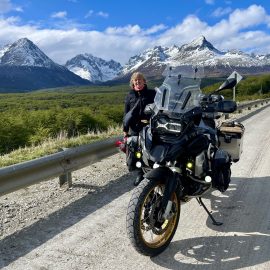
The blue dot at the bottom is Ushuaia, ‘The End of The World’ and the furthest point south we will travel.
The blue dot in the east is Buenos Aires where we fly home in December.
It’s about 2,000 miles to Ushuaia and another 2,000 miles up to Buenos Aires.
Hope this map of our progress isn’t too dotty.


A wonderful adventure and achievement travelling in South America, you are both real explorers, also the real McCoy’s. 👌👍
LikeLiked by 1 person
Thx 🙏
LikeLike